Runequest Thursday #63 - Isometric Map of Brightwater!


For the current adventure in my ongoing Runequest Brightwater campaign, set in the River of Cradles region, the settlement is under attack by a raiding band of vicious scorpionfolk. Of course it had to happen during the seasonal Waterday Market of Brightwater, so there are lots of extra people around to protect [and in some cases to aid in the defense].
One of the things I did with the Players before last game [which culminated in the beginning of the scorpionfolk attack] was to get them to plot out on a map board where the various parts of the settlement are, on the piece of land they have chosen. I drew out the topography, made up some sticky notes with different labels on them for things like 'Archers' Stand' or 'Great hall' and let them decide where each piece would go. By adding some things I had forgotten about, and about half an hour of fun planning, the Players were able to come up with the layout of Brightwater.
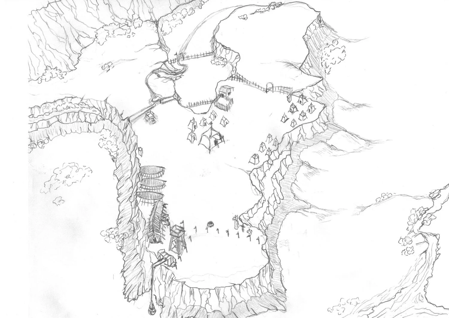
That left me with taking those notes and turning them into an actual map. I really like the look of isometric maps for giving you a better sense of a place as 'alive' rather than just a collection of caves, rooms, building, or what-have-you. So I decided to try drawing an iso-map of Brightwater. It is my first attempt, and I can see some things that i would change [and probably will] but overall, I think it came out all right. I am posting a larger copy of the may as an attachment, in case anybody wants to file off the serial numbers and use it for their own games. I am also keeping the map free of numeration, labels or a title for much the same reason. I freely grant permission to copy or modify for your own use. Just don't use it commercially, please.
Now, why don't I give you the nickel tour. Starting with the area around Brightwater itself.
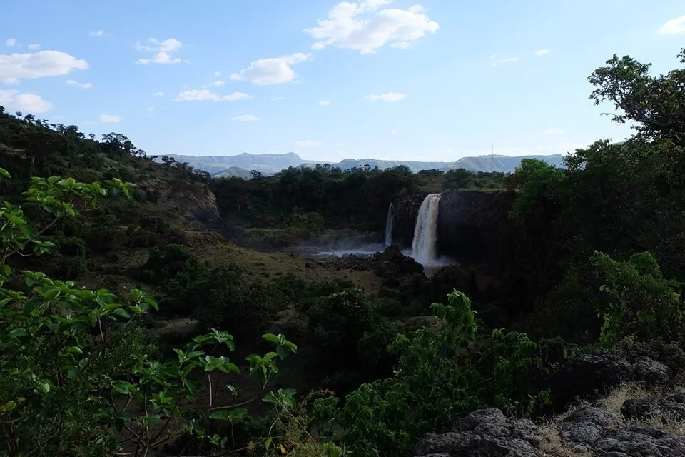
Brightwater is a young settlement of roughly 150 folk, just a little over two seasons old, so a lot of what is on the map is the natural look of the region, and some wooden and cloth structures. The foreground of the map is the easternmost point, overlooking the River of Cradles and the Great Bog [both of which are off-camera, as it were]. The waterway in the lower right is the mouth of the Viilinar River, which extends for a dozen miles up the increasingly rugged Vilinar Valley to the Weis Cut and a seasonally impressive waterfall from the Plains of Prax. At the top of the map are the cliffs that rise several hundred feet to points on those same plains much closer to the settlement. The only way off the plains nearby is by a long and dangerous descent down the sandstone cliffs or flight.
Brightwater is situated on a 'Y'-shaped headland of a lower set of cliffs branching off the ones that lead up to Prax. The heights vary between thirty and seventy feet above the Great bog and the River of Cradles. The highest points are the easternmost point with the observation tower, and some hilly areas in the right-hand [Northern] arm of the Y. There is little in the way of trees on the headland, but some tough brush and scrub oak cling to the lee of various rock faces, or in small sheltered valleys, These woods are rapidly being reduced as the need for firewood and building material grows.
As you can see most of the building has gone on in the foreground area. The aforementioned Observation Tower has a small siege machine christened 'The Manticore' [essentially a Roman 'scorpion' bolt thrower that can hurl 2 pound bolts about 400 yards. Built by local labor directed by Theudulf the Learned, it has a fine view of the riparian approach from the south. Work has begun on one or two more manticores for placement elsewhere.
Next to the Manticore tower is the Great Hall, built in the Sartarite style and still rough hewn, smelling very much of cut-wood and pine tar. It was only completed a week or so ago, but provided shelter [under tent roofs] for sometime before. This is also quickly becoming the social hub of Brightwater, replacing the more central Great Tent as the gathering place [except in good weather, when it is the choice for crafts and similar]. The three halls just above the Great Hall are lesser halls in the same style. In truth, at present, they are little more than flattened earth and growing piles of logs poled down from the Upper Vilinar, but I wanted to put them there to show the Players what they have to look forward to. The tiny building just above the halls is a latrine. There is another across the settlement, just below the fence to the Pasture.
Continuing from the Jakes, one would reach the Archers' Stand, a mound of packed hearth about 10 feet high, protected by a waist high wooden wall on three sides. The Archers' Stand [which can shelter six archers with room to shoot] overlooks the Wall and Ditch that protects the only ready access to the Headland and Brightwater.
The Wall is rough mortared field stone over a bank of raised earth from the ditch. The stone extends higher in front of the mounded earth, providing some cover for those standing behind. I did not show this in the map, but the rampart for walking is elevated by about 4 feet, and the wall facing west is about 4 feet higher than that. Invisible from this angle is the Ditch immediately outside the wall. The ditch is about 5 feet deep and the same wide. The Wall and Ditch together present a formidable barrier to assault, being effectively a 13 feet high barrier to anyone outside. Currently, sharpened posts angling away from the wall are being erected before the ditch to discourage charges.
Directly before the gap in the wall there is another charge breaker, A wall much the same as the one just described but only about 30 feet long, in front of, and across the opening. This is a feature that is used often by settlers in the Big Rubble to stop Rhino RIders or other powerful cavalry smashing in gates. In the image I forgot to add a gate, but there is a pair of wooden gates. Typically these are open during the day, given the view the guards on the Archers' Stand have of the Approach.
The only way up onto the Headland is the Approach, which now has something of a road [treacherous and running with muck in Sea Season, but good for the rest of the year]. You can see that the road descends a scree slope into the Paddock, which is fenced and used as grazing for extra animals or those of visitors. The Little Valley is surrounded by 40 foot high vertical sandstone walls. In the nearest part, you can see another fence, in which young or other animals to be segregated are kept. The high ground outslde the Wall Is grazing, sometimes granted to friends of Brightwater. Wahakhan Barsun Spiritlance and his clan of friendly Rhino Riders often camp here with their beasts and wagons, as do the Sabre Lizard nomads of Aghu Wahakhan.
Much of the Paddock can be seen from the Archers' Stand, as can the road and access to, and from,the Vilinar Valley. This has proven advantageous on a number of occasions, giving the Brightwaters time to mobilize in defense.
Moving North along the wall, we overlook the Paddock, and arrive at a cluster of tents used primarily by the Weisfolk who abandoned their village upriver to settle in Brightwater. These are slightly less desirable than the tents further north because of their location between the Smithy and corral, and the Great Tent, mostly because of noise.
Across a road that I did not draw in [I will, and I will repost the Map in a day or three, along with a couple of other additions], are the original tents belonging to the settlers that the Brightwater Company recruited from Pavis and environs. Many are Pavisites, others are Sartarite emigres from beyond Prax, fleeing the Lunar Occupation, or the children of Sartarites who left a generation ago. Some are other river folk, who share a language and culture with the Weis folk but lived elsewhere.
West of the Tents, at the top of the page is the Pasture. a fenced enclosure for herd animals and horses. Sun Elk, captured Sables, cattle, sheep and Aurochs, as well as cavalry horses for some of the players characters, are kept here under watch of pasture guards. The Fence was built where it was because of loose ground and dangerous slipways, which nearly caused a tragedy during the first week. Now fences ward both sides of the two slipways, keep animals and children safer.
Finally, strolling down the open area before the Great Tent we come to the Shrines of the Settlement. There is a shrine to the River Horse, one to Humakt, and one to Orlanth that can be camouflaged as a shrine to other Lightbringers if the Lunars show up. In addition, the Well, just left of the Shrines, is a shrine and home to a River Maiden, a daughter of Zola Fel, convinced by a player character shaman to live there in exchange for regular offerings of power. She keeps the drinking water of Brightwater sweet.
The area within the flagposts is laid out for the eventual erection of stone fortifications on the site - a castle. At present, it is the parade and drill area for the militia, and the practice area for any who work with weapons.
The last item on the map, in the lee of the Manticore Tower, is the Lift. A set of pulleys, worked by an Aurochs or a pair of Zebra, can lift several hundreds of pounds of rocks, earth, fish or even passengers if they don't mind riding up in a rather dirty , smelly rope net. Directly below the Lift, on the valley floor, there are seasonal smoking fires and drying racks for fish or game.
That is about all for now. As more is built, i will update things as they change.